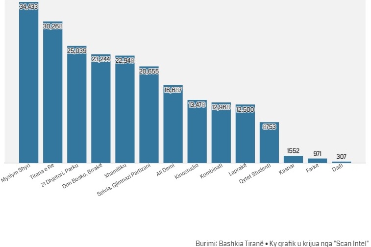
“Scan Intel” has processed the data of Open Data, Municipality of Tirana, regarding population density according to administrative units:
Population density is calculated as the average number of people per square kilometer in a given space. Thus, the administrative units “Myslym Shyri”, “Tirana e Re” and “21 Djetori” are more populated, compared to the units “Dajt”, “Farkë” and “Kashar” as the neighborhoods with the least population density.
What stands out is a significant increase in density in areas such as “Kashari”, “Farka” and “Dajti”, which are peripheral units.
It seems that the future trends of “Tirana” go towards the “abandonment” of the old areas, noisy centers and moving to the suburbs, where it seems that life is quieter. This trend of the last 10 years is closely related to the desire to move from old, slightly depreciated buildings to new ones located in more peripheral areas, with significantly better living conditions.
Population density of Tirana, according to administrative units, Q1 2022
More info & source: